A Map of Nairobi National Park and Its Environs
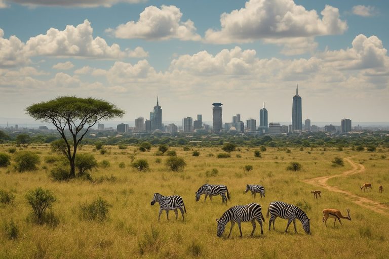
Exploring Nairobi National Park becomes more rewarding when you can see the big picture — not just the park itself, but how it fits into the surrounding city. This beautifully illustrated map of Nairobi National Park and its environs offers you a clear, accurate, and practical view of the park and its nearby urban areas, helping you as a traveler, driver, or researcher to plan your routes with confidence.
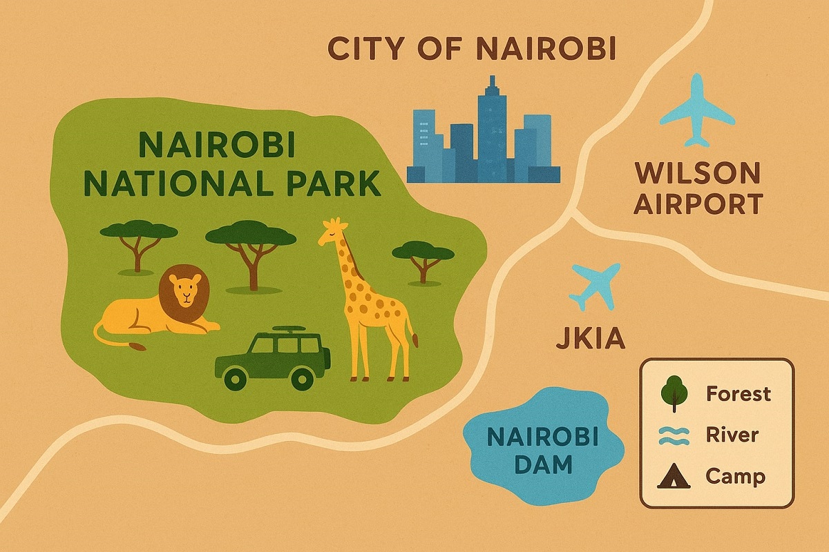
This detailed map covers the entirety of Nairobi National Park and its immediate surroundings, including notable areas such as Jomo Kenyatta International Airport, Wilson Airport, Chiromo, Eastleigh, and Nairobi Dam. Designed at a scale of 1:50,000, it provides an excellent balance between wide coverage and fine detail, letting you see how the park fits within the greater Nairobi landscape.
Planning a game drive, researching the city’s greenbelt, or simply curious about the geography around the capital, this map offers you a rare bird’s-eye view of how nature and urban life blend side by side.
???? Nairobi national park and its environs Map Specifications
- Scale: 1:50,000
- Size: Folded – 6 x 8 inches; Unfolded – 24 x 18 inches
- Material: High-quality paper (lightweight and easy to fold)
- Year Published: 2025
The compact folded size makes it easy to slip into a backpack or glovebox, while the large unfolded sheet offers generous space to study routes, terrain, and key landmarks.
???? Features Shown on the map
Printed at a scale of 1:50,000, this map captures a wealth of detail on a 24 × 18 inch sheet (folded to 6 × 8 inches) and is loaded with practical details to support both navigation and exploration:
Key features include:
- Park gates
- Main and secondary roads
- Park access roads and minor tracks
- Management tracks used by park rangers
- National park boundaries and provincial boundaries
- Forested areas, grasslands, and scattered tree zones
- Contour lines and altitude tints for elevation
- Rivers, dams, boreholes, and water holes
- Camps, picnic sites, park gates, sign posts, and safari lodges
- Railway line crossing nearby areas
These features help you navigate both the natural and built environments seamlessly while each element is carefully symbolized and color-coded, allowing you to quickly interpret the terrain and facilities around you — even in the field.
????️ nairobi national park and its environs Map Legend
The map’s legend clearly explains every symbol and color used. From contour lines showing elevation to different styles of roads, boundary markings, forest cover, and tourism facilities, the legend makes the map easy to read even for first-time visitors to the park.
This Nairobi National Park and its environs map legend is your key to interpreting the symbols and colors on the map. It shows:
- Road networks — solid lines (main roads), dashed lines (secondary or park roads)
- Boundaries — clear lines marking provincial and park borders
- Natural features — tree icons for forests, blue lines for rivers, dots for water holes
- Facilities — tents for camps, table icons for picnic sites, gates and lodges marked with unique symbols
- Relief — contour lines and shaded altitude bands indicating elevation changes
With this legend, even first-time map users can quickly understand what they’re looking at.
???? Surrounding Areas Shown
Beyond the park’s official boundaries, this Nairobi National Park and its environs map spans the entire Nairobi National Park and the surrounding area within Nairobi City, giving you an unmatched perspective of where nature meets the city.
The coverage extends beyond the park boundaries to include:
- Jomo Kenyatta International Airport
- Wilson Airport
- Chiromo
- Eastleigh
- Nairobi Dam
This broader context is especially useful for visitors planning their entry and exit routes or scheduling stopovers around Nairobi city and is ideal for understanding entry routes, nearby amenities, and the relationship between the park and central Nairobi.
???? Why This Nairobi national park and its environs Map Is Valuable
While online navigation apps are useful, they often fail inside the park due to poor internet coverage and lack of detailed tourist features. This physical map works offline, gives you the full picture at a glance, and can be spread out for group route planning during safaris. It also makes a timeless souvenir of your Nairobi adventure.
???? this nairobi national park and its environs map is Ideal For
This map blends tourist-friendly clarity with professional cartographic detail and is a reliable companion for anyone visiting or studying the park, especially:
- Tourists and safari-goers
- Drivers navigating routes near the park and airports
- Hikers, bird watchers, and nature photographers
- Conservation researchers and geography students
- Tourists exploring Nairobi National Park
- Safari-goers planning self-drive routes
- Nature enthusiasts
- Researchers and field students studying wildlife and conservation
- Drivers and guides navigating the park and surrounding city
???? Usage Tips of the map
Unfold the map before your trip and highlight the key roads, gates, and picnic spots you plan to visit. Carry it in a waterproof sleeve if heading out during the rainy season.
- Carry it during your game drives to follow trails and locate picnic areas.
- Use it offline where mobile networks are unreliable.
- Combine it with a digital map app for GPS positioning if needed.
- Refold neatly along the original creases after use to keep it in top shape.
After your trip, safely refold the map and keep it as a reference or souvenir.
???????? Nairobi National Park and Its Environs map Price and how to order
This map is printed on durable paper and designed for long-term use and the Price is just KES 1,000 (approx. USD $7.50).
How to Order: Ordering is simple — contact us through the Cute Kenya contact page or WhatsApp to reserve your copy. We will confirm availability and arrange for your preferred pickup or delivery option.
???? Delivery / Pick-Up Options
We offer delivery for this map across Kenya. We can organize affordable courier delivery within Kenya via local courier providers or matatu. If you are in Nairobi, you’ll enjoy same day delivery if your order by 3PM (Monday-Friday) and by 1PM (Saturday) via matatu or boda boda and the delivery cost will depend on your location and mode of delivery. Matatu is cheaper but you must be at the stop to pick it up. NB – we do not deliver on Sundays.
If you are a visitor from abroad, kindly reserve online and get your map delivered to your address upon arrival in Kenya. The delivery fee as above will depend on your location and mode of delivery. Pickup from Nairobi CBD is free. This Map of Nairobi National park and its environs is packaged securely to protect it from folds and moisture during shipping.
???? Final Thoughts
This map is more than a navigation tool — it’s your key to understanding how Nairobi National Park sits within the vibrant city of Nairobi. With its rich detail, durable format, and clear design, it’s an essential resource for anyone who wants to experience the park and its surroundings with confidence.