A Map of Nairobi National Park and Its Environs
Exploring Nairobi National Park becomes more rewarding when you can see the big picture — not just the park itself, but how it…
????️ Kenya Travel Maps – Exploring Kenya becomes easier and more exciting when you have the right map in hand. Our Cute Kenya Travel Maps collection is designed to help you navigate the country’s most stunning destinations with confidence. From bustling city streets to serene national parks and dreamy coastal towns, these maps give you a clear picture of where you are and where you’re going.
Whether you’re planning a wildlife safari, a beach getaway, a cultural road trip, or just want to understand Kenya’s geography better, these maps are the perfect companion. Each one is crafted or sourced locally for accuracy and detail, making them ideal for travelers, tour guides, students, and anyone who loves discovering new places.
???? How it works: Browse through the individual map posts to discover maps of parks, reserves, cities, beaches, road routes, and more. If you find a map you’d like to get, simply contact us through the details provided at the bottom of each post, and we’ll help arrange how you can pick it up when you arrive in Kenya or ship it to where you are after a shipping mode arrangement…
Our Kenya Travel Maps collection covers a wide range of destinations and travel styles. Each type of map is designed to give you exactly what you need for the journey ahead:
Explore Kenya’s vibrant urban centers like Nairobi, Mombasa, and Kisumu. These maps highlight key neighborhoods, attractions, transport hubs, hotels, and walking routes.
Navigate iconic wildlife destinations such as Maasai Mara National Reserve, Amboseli National Park, Tsavo National Park, Nairobi National Park, and more. They include park gates, game drive routes, picnic sites, lodges, and animal viewing zones.
Perfect for laid-back getaways at Diani Beach, Lamu Island, Malindi, and the Watamu Marine National Park. These show resorts, dive/snorkeling spots, historic sites, and transport links.
Handy for planning long drives and road trips. They cover major highways, scenic routes, fuel stations, rest stops, and distances between key towns across Kenya.
Themed maps for niche explorers — from hiking trails and cycling paths to cultural heritage circuits, birdwatching areas, and safari migration routes.
While digital maps are quick and convenient, a physical map gives you the big picture in a way a small screen never can. They work offline, never run out of battery, and are easy to spread out for planning routes at a glance.
This becomes especially useful in remote parks and rural areas of Kenya, where mobile signal and internet can be unreliable. Plus, a printed map makes for a beautiful keepsake of your adventures — a tangible reminder of the places you’ve explored.
Getting your hands on our Kenya travel maps is simple and flexible — designed to fit smoothly into your travel plans:
???? We currently offer local pickup and custom delivery within Kenya. International shipping can be arranged on request.
To get the most out of your trip, pair your map with a simple travel plan. Mark out must-see spots, nearby attractions, and overnight stops before you set off — it saves time and helps you discover hidden gems along the way.
In addition, we have two companion resources that will aid your travel.
And remember: a good map isn’t just for navigation — it’s part of the adventure. Keep it safe, and it’ll become a treasured souvenir of your journey across Kenya. ????
If you need any clarification, have a question, or need assistance, kindly reach out to us…
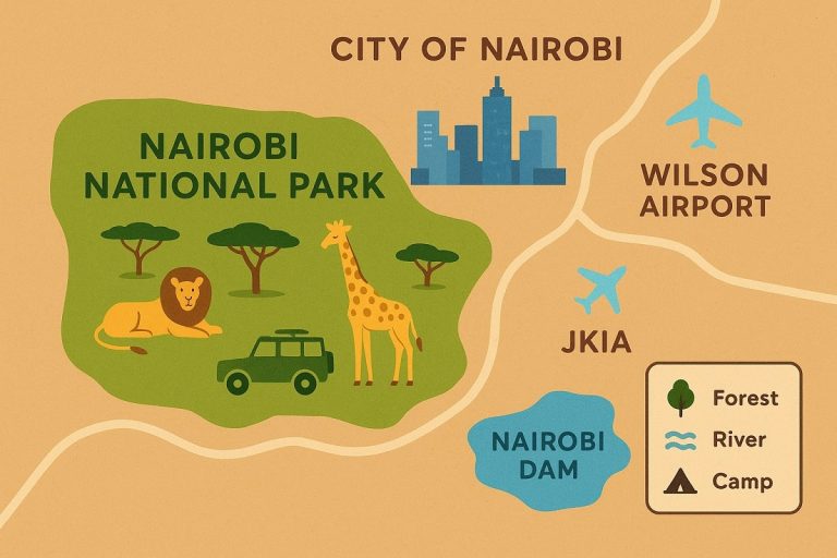
Exploring Nairobi National Park becomes more rewarding when you can see the big picture — not just the park itself, but how it…